 |
Astro Blog
 Astronomy and
Navigation (also
in French)
|
«Astronomy and
Navigation » |
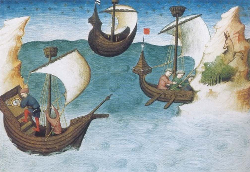 |
For human beings on earth, one of the best views one can have of the celestial vault with its myriads of stars is from very specific places, far from artificial lights and free from any obstacles, such as on the huge surface of the oceans or in vast deserts. In such places, the absence of any significant natural landmarks offers an unobstructed view but also makes it necessary to find a specific means of determining ones position and direction. Probably from the dawn of humanity, the stars have been used for this purpose. Astronomy and navigation are therefore linked together, deep in human history.
In European culture, a famous account of the navigation by the stars is provided by the Odyssey, the evocative poem attributed to Homer around the 8th century BCE, describing the voyage of Odysseus (Ulysses), guided by the goddess Calypso : “He[Odysseus] sat and guided his raft skillfully with the steering-oar, nor did sleep fall upon his eyelids, as he watched the Pleiads, and late-setting Bootes, and the Bear, which men also call the Wain [...]. For this star, Calypso, the beautiful goddess, had bidden him to keep on the left hand as he sailed over the sea” [1].
 |
| Polynesian star compass : star compass
marked with star names in Satawalese Micronesian language (North is up,
East right) |
In fact,
relatively precise navigation is possible without any instrument by the
sole observation of the stars. Modern expeditions have completed the
2500 miles navigation from Tahiti to Hawaii in about a month, without
any instrument, using a 19m double- hulled Polynesian canoe equipped
with sails, illustrating the way the different Pacific islands were
colonized starting about 3000 years ago [2]. The technique is called
‘sailing down the latitude’ that is, in this case, sailing
approximately north until a precise latitude is reached and then
steering west keeping the same latitude. The latitude can be estimated
quite accurately by the elevation above horizon of a given star or
constellation such as the distinctive Southern Cross.
As any
given star always rises or sets above the horizon at a same fixed
azimuth, the stars form a natural compass.
Arabs and Chinese navigators used this 'star compass’ across the Indian
Ocean. Around the equator, the star rising-setting directions only
slowly change with latitude and therefore can be used for long-term
navigation. This ‘astronavigation' has of course to be
complemented by sun observations during the day and also by the ability
to keep course with respect to waves and to locate land by the cloud
observations and bird watching.
 |
| Arabic star compass : the sidereal compass
rose is composed by 17 different stars (North, South and 15
intermediate stars) |
As sky
configuration and star identifications have to be memorized, this led
probably to the first star charts. The earliest known star map was
found in the Gobi desert [see “the Dunhuang star chart”] incorporating
the traditional Chinese constellations. During the Islamic expansion,
Persian-Arabic astronomers such as Al-Sufi (903-983 CE), designed
detailed inventories of constellations (see “the Book of fixed stars”]
that were the basis of navigation instruments.
Navigation by eye estimation is however limited in accuracy and more
specific instruments were soon introduced with increased maritime
exchanges. In any location, precise latitude can be estimated by the
altitude above horizon of the geographic North Pole, close to the
Polaris star. For this measure, Arab seafarers were first using
different types of quadrants, basically a graduated quarter-circle with
a plumb line attached to the centre. With one edge aligned toward
Polaris, the vertical plumb line marks the elevation angle read on the
graduated scale.
Contrary to what often stated, the complex astrolabe [see “The earliest known astrolabe”] was not directly used for navigation but was adapted in a simplified version, the sea or mariner’s astrolabe. One of the most precious specimens, a 17.5cm diameter bronze disc finely graduated, was excavated in 2014 in the wreckage of Esmeralda, a Portuguese ship from the Vasco da Gama’s fleet, which sank in 1503, off the Oman coast [3].
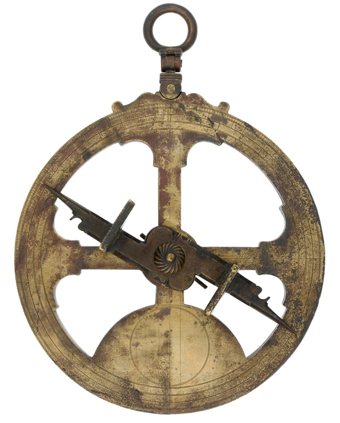 |
| Mariner's astrolabe (1588): Typical
marniner's astrolabe or sea astrolabe used on board ships. The brass
disc, that should be used strictly vertical, is cut away to reduce wind
pressure at sea. A pivoting rule or alidade, equipped with two sights,
is used to measure star elevations. This specimen was recovered in 1845
off Ireland, from the wreckage of Spanish Armada ships sunk in 1588. |
The magnetic compass invented in China was also used concurrently to provide steering directions when no star was visible, as attested in China from around 1100 CE.
 |
|
Chinese
magnetic compass : replication of a magnetic compass from the Han
dynasty (206BCE - 220CE). Known as the "si nan", the south indicator,
it consists of a lodestone (or magnetized iron) spoon with its handle
pointing to the south, placed on a square plate with geographic and
geomantic symbols. Such magnetic device was later adapted for
navigation by using a magnetized needle suspended by a silk fibre or
floating on a bowl of water.
|
[1] Homer (1919) "Odyssey, Book V, 265", trans. A. T. Murray, Loeb Classical Library, Harvard University Press, Cambridge; William Heinemann, London
[2] see the account of the sea expedition from Tahiti to Hawai in 1980 without instruments
https://archive.hokulea.com/holokai/1980/nainoa_to_hawaii.html
[3] "Earliest known marine navigation tool revealed with scanning technology", University of Warwick, 24 October 2017 https://warwick.ac.uk/newsandevents/pressreleases/oldest_known_marine/
Further Reading:
- de Saussure, L. 1923, “L'origine de
la rose des vents et l'invention de la boussole”, Archives des
sciences physiques et naturelles, Genève. 1923, vol. 5, mai-juin pp.
149-181 ; vol. 5, juillet-août, pp. 259-273 [reprinted in Ferrand
(1928) p. 31-127].
- Ferrand, G. 1928, “Instructions
Nautiques Et Routiers Arabes Et Portugais des XVe Et XVIe Siècles
reproduits, traduits et annotés; Tome III Introduction à l'Astronomie
Nautique Arabe”, Librairie Orientaliste Paul Geuthner, Paris
1928.
- King, D.A. 1987, “Islamic
Astronomical Instruments”, V. London: Variorum Reprints, 1987
Kyselka, W. 1987, “An Ocean in Mind”, University of Hawai'i Press
- Mörzer Bruyns W. F. J., Dunn R. 2009 “Sextants at Greenwich: A Catalogue of the Mariner's Quadrants,
Mariner's Astrolabes Cross-staffs, Backstaffs, Octants, Sextants,
Quintants, Reflecting Circles and Artificial Horizons in the National
Maritime Museum, Greenwich”, Oxford Univ. Press, 2009
The earliest known astrolabe is an Islamic planispheric instrument
precisely dated 927/928 CE and preserved in the Kuwait National Museum.
The 20 cm diameter disk is made of brass and the maker’s name and date
are indicated below the suspension ring as « Made by Nasṭulus in the
year 315 », with the date given in the year of the Hijra. Little is
known of Nasṭulus who was possibly the Muslim astronomer Muḥammad ibn
ʿAbd Allah working in Baghdad.
The astrolabe is a complex instrument mainly designed to compute date
and time from the stars or sun altitudes and vice-versa. The front face
realized a stereographic projection of the celestial sphere. It is made
of a background plate (the mater) graduated in altitude and azimuth on
which is superposed a rotating hollowed disk (the rete) bearing
pointers representing a number of fixed stars. On the back, a rotating
bar with two aligned sights (the alidade) allow to measure the star
altitudes when the astrolabe is hold vertical suspended by its ring on
the top (the throne). The astrolabe was intensively used during the
Islam period to schedule Muslim prayers, find the direction of Mecca as
well as for navigation. For this last purpose however, a
simplified version was mostly used, the mariner’s astrolabe, with parts
of the disc cut away to reduce wind resistance on ships.
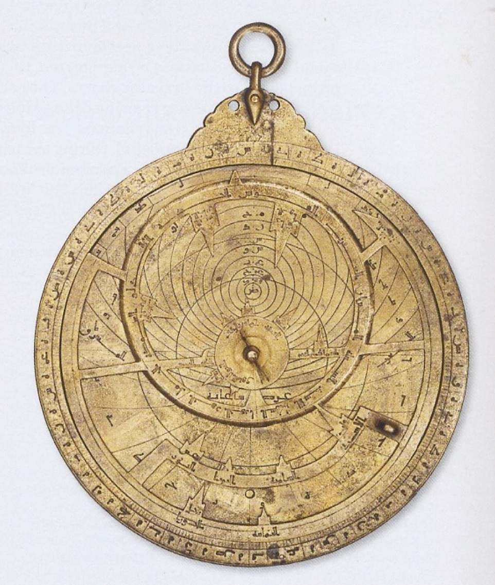 |
| Nastulus astrolabe (dated 927 CE) |
Further
Reading:
King, David A. 1987, “A Note on the Astrolabist
Nasṭuulus/Basṭulus.” Archives internationales d'histoire des
sciences 28: 117–120. (Reprinted in King, Islamic Astronomical
Instruments, IV. London: Variorum Reprints, 1987).
Stimson, Alan, 1988, “The Mariner's
Astrolabe: A Survey of Known, Surviving Sea Astrolabes”, Coimbra
UC Biblioteca Geral 1, 1988
Morrison E. , "The Astrolabe: An
instrument with a past and a future"
https://www.astrolabes.org
The Book of Fixed Stars (Kitab al-Kawakib al-Thabita) is the earliest
known document providing a complete description of the Arabic stellar
constellations. It was composed around 964 CE by the Persian astronomer
‘Abd al-Rahman al-Sufi (903–986 CE).
The Arabic text gives a deeply revised version of the star catalogue
included in the Almagest (Mathematika Syntaxis), an astronomical
treatise composed by the Greek-Roman Ptolemy (c. 100–170 CE),.
It includes 55 astronomical tables listing ecliptic coordinates of 1022
stars, taking into account precession. Charts corresponding to 48
different constellations are also presented in two different forms, one
as seen as in the sky, the other as a mirror version seen from above as
depicted on a celestial globe. The figure of each constellation is
drawn bearing the Arabic star names.
The original copy of al-Sufi's manuscript is no longer extant. The
oldest version is thought to be the manuscript MS. Marsh 144 (Bodleian
Library, Oxford). It is dated 1009 CE by its colophon which states that
it was composed by Al Sufi’s son, but parts may have been added up more
than a century later.
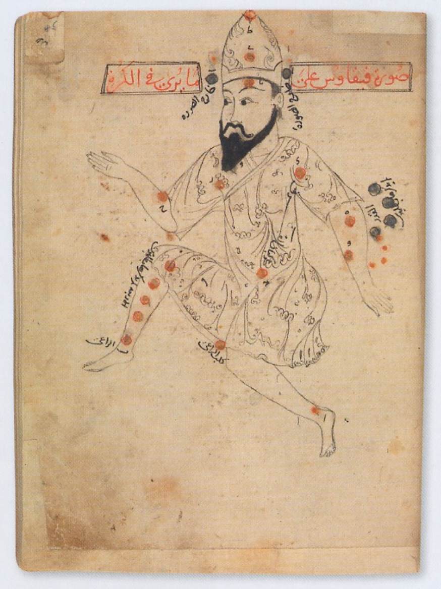 |
| The Book of Fixed Stars (915 CE) |
Further Reading: Hafez 2010; Schjellerup,1874.
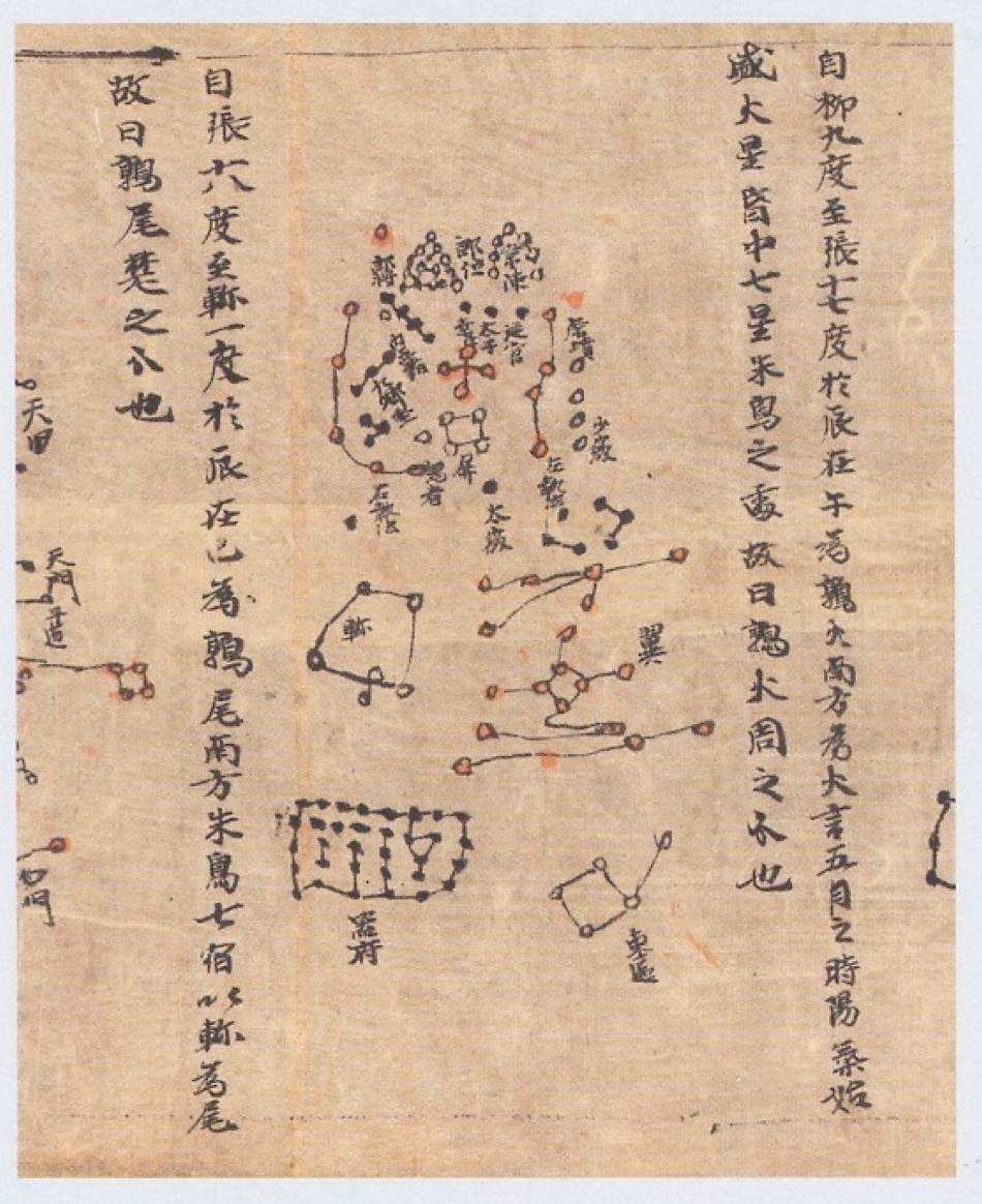
The Dunhuang Star Chart is the world's oldest complete preserved star
atlas. The document was discovered in 1900 in a hidden sealed cave of
an old Buddhist monastery, the Mogao Caves, near the Silk Road town of
Dunhuang at the Western end of the Gobi desert.
The well preserved star chart is finely handwritten on a paper scroll
of total length 210 cm and width 25 cm, displaying more than 1,300
stars grouped into 257 named Chinese constellations. It displays the
full sky visible from China, rigorously organized into 12 equatorial
panels complemented by a circular map of the North Pole region. A
detailed scientific study showed that the positions of the brightest
stars are surprisingly accurate to within a few degrees, in accordance
with a rigorous projection similar to the modern ones.
The document has been dated from to between 649 and 684 CE and, from a
mention in the text, its most probable author is Li Chunfeng, an
astronomer of the early Tang dynasty.
Such accurate inventories of stars and maps were commonly used in China
for prognostications, locating transitory astronomical phenomena and
general orientation, including land and sea navigation.
The chart is presently part of the Chinese collection of the British Library
 |
Further Reading:
On-line document : Manuscript Or.8210/S.3326 at International Dunhuang Project
http://idp.bl.uk/database/oo_loader.a4d?pm=Or.8210%2FS.3326
Bonnet-Bidaud J.M., Praderie F., Whitfield S . 2009, « The Dunhuang Chinese sky : a comprehensive study of the oldest known star atlas », Journal for the Astronomical History and Heritage, vol. 12, No. 1, p. 39, 2009. (article PDF version)
Whitfield, P., 1995, « The Mapping of the Heavens ». London, British Library.
Read
the published article in Astronomy and Navigation (PDF)
"SILK ROADS
: Peoples, Cultures, Landscapes", p. 402-407
Edited by Susan Whitfied, Ed. Thames & Hudson (2019)